Napa Valley Winery Map and Subregions Guide
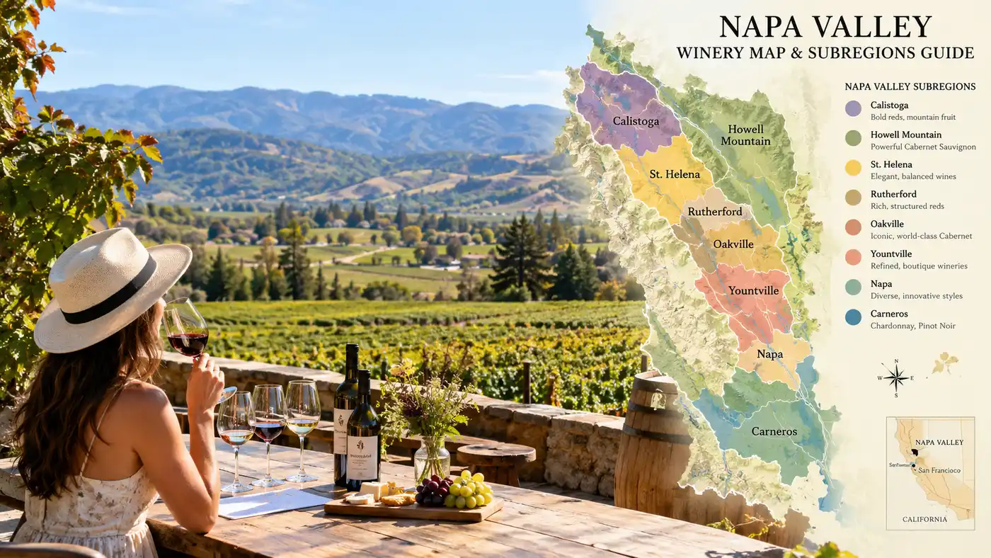
Most first-time visitors look at a map of California, spot the small patch north of San Pablo Bay, and assume wine tasting here is a simple afternoon drive. Then they arrive on Highway 29 on a Saturday afternoon in July. The strip of asphalt between Napa city and Calistoga is only 30 miles long and barely 5 miles across at its widest spot, yet navigating it without a spatial plan guarantees you will spend more time staring at brake lights than sipping wine. Having a clear napa valley winery map in your head, or tucked into your center console, changes the entire rhythm of your trip.
The valley holds 16 nested American Viticultural Areas (AVAs), each defined by radical shifts in temperature, elevation, and prehistoric soil deposits. You can stand in Carneros wearing a wool sweater in 60-degree marine fog, drive 35 minutes north, and step out into 92-degree sunshine among the volcanic boulders of Calistoga. Understanding where these distinct pockets sit, and which grapes thrive in them, turns an overwhelming list of estates into a logical travel route.
Book your napa valley wine tasting experience:
Reading the Napa Valley Wine Map: Valley Floor vs. Mountain Ridges
Geography dictates everything here. Where is Napa Valley located? You will find it roughly 50 miles northeast of San Francisco, cradled between two distinct mountain ranges. The Mayacamas Mountains form the western wall, separating Napa from Sonoma County. On the east, the Vaca Range forms a rugged border with the Central Valley. Two primary arteries run the length of the valley floor: Highway 29 on the west and the Silverado Trail along the eastern bench.
People often ask how many wineries are in Napa Valley. There are over 475 physical wineries operating in the county, with more than 700 grape growers farming roughly 45,000 acres of vines. If you include custom crush labels and private labels pouring out of shared facilities, the total count pushes past 1,000 brands. You cannot see even one percent of them in a three-day weekend. Splitting the valley into three geographic zones - lower, central, and upper - keeps your driving manageable.
Pro tip: Skip Highway 29 between 1:30 PM and 5:00 PM on weekends. Use the Silverado Trail to move north and south, then cross east-west using connectors like Oakville Cross Road or Zinfandel Lane.
Elevation makes a massive difference in your glass. Valley floor fruit gets baked in afternoon heat, yielding plush, velvety tannins and opulent dark fruit. Mountain fruit from Howell Mountain, Mount Veeder, or Atlas Peak fights thin, rocky soil and dramatic diurnal temperature shifts. These high-altitude vines produce thick-skinned berries with tight, muscular structures that take a decade to soften. When mapping out a day of tastings, pairing a valley floor stop with an afternoon mountain vineyard gives your palate a striking lesson in terroir.
Lower Napa: Carneros and Downtown Napa Wineries
Carneros sits right at the base of the valley, dipping its toes into the muddy fringes of San Pablo Bay. Because of that proximity, it belongs simultaneously to Napa and Sonoma. The marine winds here blow hard and cold almost every afternoon, chilling the vineyards and keeping the ripening slow. Cabernet Sauvignon hates this weather. Instead, Carneros is pure Pinot Noir and Chardonnay territory, along with crisp sparkling wine houses like Domaine Carneros and Artesa.
The scenery here looks nothing like the manicured, oak-shaded corridors up north. Rolling, treeless pastures run across shallow clay soils that restrict vine roots. Tastings in Carneros feel open and breezy. A morning tasting out on a terrace overlooking the southwest hills gives you clear views all the way toward the San Francisco skyline on crisp autumn mornings.
Just ten minutes northeast lies the city of Napa. Ten years ago, tourists fled the city immediately after parking their rental cars. Today, downtown Napa wineries and tasting rooms make it an ideal, walkable home base. You can sample high-end mountain Cabernet at tasting salons along First Street, walk over the pedestrian bridge to Oxbow Public Market for oysters, and walk back to your hotel without ever touching a steering wheel. It works well for late-evening tastings when you want to avoid the country roads after dark.
- Carneros wine focus: Traditional-method sparkling wine, cool-climate Pinot Noir, and unoaked Chardonnay.
- Downtown tasting style: Urban storefronts, shared tasting lounges, and late afternoon walk-in flights.
- Best driving strategy: Hit Carneros as your first morning stop on the way up from San Francisco or Oakland airports.
Heart of the Valley: Yountville, Oakville, and Rutherford
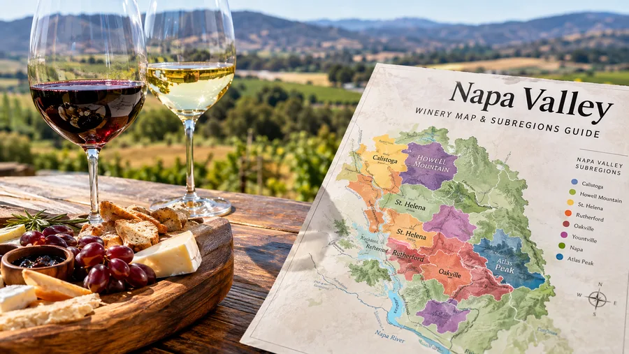
This is the core of classic Napa. If you close your eyes and picture luxury tasting rooms framed by olive trees and historic stone cellars, you are picturing this central stretch. Yountville marks the southern boundary of this golden corridor. It functions as the culinary capital of Northern California, home to The French Laundry, Bouchon, and a dense cluster of high-end tasting rooms. The wines here bridge the gap between cool-climate Carneros and the heavy warmth further north, producing balanced, perfumed reds.
Cross over into Oakville, and you enter the kingdom of benchmark Napa Cabernet. Here you find legendary dirt: To Kalon Vineyard, Opus One, Robert Mondavi Winery, and Far Niente. The soils in Oakville are deep gravelly loams deposited by ancient stream beds washing off the Mayacamas. If you want to dive deeper into how these soils shape the wines, check out this guide to the specific grapes Napa Valley is known for across various AVAs.
Rutherford sits directly adjacent to Oakville, famous among collectors for the elusive "Rutherford Dust" - a tactile sensation of powdery, cocoa-fine tannins and dried herb aromas. Inglenook, Beaulieu Vineyard, and Caymus call this subregion home. The valley broadens slightly here, catching intense sun exposure from early morning until the western hills cast their shadows in late afternoon.
Note: Almost all wineries along Highway 29 in Oakville and Rutherford require appointments booked weeks ahead. Walk-ins are virtually extinct at premium estates throughout this central corridor.
Book your napa valley wine tasting experience:
Upper Valley: St. Helena and Calistoga Wineries
As you pass north of Zinfandel Lane, the valley narrows dramatically, squeezing the vineyards against the hillsides. St. Helena serves as the historic heart of the valley. Charles Krug founded the area's first commercial winery here in 1861, followed shortly by Beringer in 1876. St. Helena feels warmer during the afternoon, but cool mountain air drains down the canyon walls at night, preserving natural acidity in the grapes. The town center retains a nineteenth-century brick storefront charm that feels rooted and authentic.
At the far northern tip sits Calistoga. Ringed by dramatic palisades and dormant volcanic formations, this is the hottest AVA in the valley. Afternoon temperatures regularly climb 10 to 15 degrees higher than Carneros. Old-vine Zinfandel, Petite Sirah, and powerful Cabernet Sauvignon dominate the hillsides. Calistoga feels casual, dusty, and unpretentious, shaped by its history as a geothermal spa town where visitors soaked in hot mineral water and volcanic ash long before wine tourism took over.
The wine trail in the upper valley rewards travelers who pull off the main strip onto narrow lanes like Larkmead Lane, Dunaweal Lane, or Tubbs Lane. You can easily spend an entire day exploring historic stone estates and modern minimalist compounds tucked against the foot of Mount Saint Helena.
| Subregion (AVA) | Primary Grapes | Typical Temperature | Atmosphere |
|---|---|---|---|
| Los Carneros | Chardonnay, Pinot Noir | Cool & windy (60-75°F) | Rolling hills, maritime, casual |
| Yountville | Cabernet Sauvignon, Merlot | Moderate (75-85°F) | Walkable luxury, fine dining |
| Oakville | Cabernet Sauvignon, Cab Franc | Warm (80-88°F) | Prestigious estates, classic valley floor |
| Rutherford | Cabernet Sauvignon, Sauvignon Blanc | Warm (82-90°F) | Historic stone cellars, heritage dust |
| St. Helena | Cabernet, Merlot, Zinfandel | Very warm (85-92°F) | Victorian architecture, heritage vines |
| Calistoga | Cabernet, Petite Sirah, Zinfandel | Hot (88-98°F) | Rugged, geothermal, rustic-chic |
Mountain Subregions and Silverado Trail Navigation
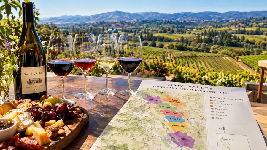
Running parallel to Highway 29 on the quiet eastern slope, the Silverado Trail is the prettiest stretch of road in the valley. It hugs the base of the Vaca Range, shaded by ancient valley oaks and offering uninterrupted views across the vines to the Mayacamas. Wineries here tend to be set back into the hillsides, often featuring hillside terraces and deep subterranean caves dug straight into volcanic rock.
Above the valley floor, the mountain AVAs operate in an entirely different climate zone. Mount Veeder and Spring Mountain perch on the western ridges, catching cool morning sun and thick afternoon ocean breezes filtering through gaps from Sonoma. Across the valley to the northeast, Howell Mountain and Atlas Peak rise well above the marine inversion layer. While the valley floor shivers under thick gray fog until 10:30 AM, mountain vineyards bathe in crisp sunshine from dawn.
Visiting mountain wineries requires careful scheduling. A drive from the valley floor up to a Howell Mountain tasting room might look like four miles on a map, but the route twists along single-lane mountain switchbacks with no guardrails, easily taking 25 minutes each way. If you want to structure your days cleanly without running late, our full Napa Valley wine tasting itinerary maps out realistic driving time windows between mountain summits and valley floor estates.
- Pacing mountain visits: Never schedule more than one mountain estate in a single day.
- Cell service reality: Cell phone coverage drops out frequently on Spring Mountain, Mount Veeder, and high Howell Mountain roads; download offline maps before heading up.
- Designated driving: Mountain curves are unforgiving after wine flights; book local transport or assign a driver when heading into the hills.
Frequently Asked Questions about napa valley winery map
How long does it take to drive the entire length of Napa Valley?
Without traffic, driving from Carneros at the south end to Calistoga at the north takes about 45 minutes. On busy weekend afternoons between May and October, that same drive along Highway 29 can easily take 90 minutes or more.
What is the difference between Highway 29 and the Silverado Trail?
Highway 29 is the commercial main street running through all the major towns, carrying heavy traffic, stoplights, and large landmark wineries. The Silverado Trail runs parallel along the eastern foothills, offering a scenic route with fewer intersections, higher speed limits, and hillside estates.
How many wineries should I visit in one day?
Two or three wineries per day is the sweet spot. Tasting appointments last between 60 and 90 minutes, and rushing between four or five stops leaves you fatigued, dehydrated, and unable to appreciate the subtle differences in the wine.
Quick Reference
- Valley length: 30 miles from Carneros to Calistoga
- Total recognized AVAs: 16 unique subregions
- Key routes: Highway 29 (west) and Silverado Trail (east)
- Total active wineries: Over 475 bonded physical facilities
Book your napa valley wine tasting experience:
Mapping Your Days Realistically
The secret to loving Napa Valley is choosing depth over distance. Rather than darting from a tasting in Carneros at 10:00 AM up to Calistoga for lunch, and then back down to Oakville for a late afternoon pour, pick one distinct subregion per day. Spend your Tuesday exploring the leafy gravel benches of Rutherford. Save Wednesday for the cooler, windswept slopes of Carneros, and dedicate Thursday to the rugged volcanic pockets around Calistoga. When you match your travel pace to the natural contours of the land, the valley opens up, and you spend your hours savoring great wine rather than watching the clock on the dashboard.
Read more about napa valley wine tasting.